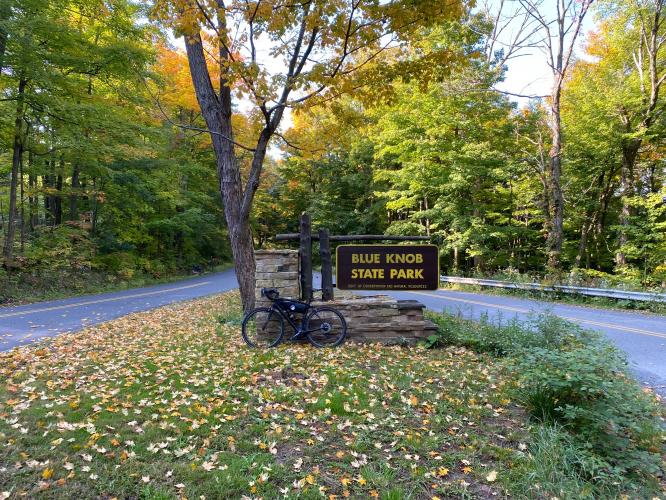
![Cycling Blue Knob/Pavia Road, Pennsylvania Cycling Blue Knob/Pavia Road, Pennsylvania - bike parked in center of grassy field with large oak tree, blue sky and hillsides behind in distance]()
Cycling Pavia Road, Blue Knob State Park, Pennsylvania
Ride 4.4 miles gaining 1,633’ at 7% average grade.
Pavia Road, located in Blue Knob State Park, is the most difficult bike climb in Pennsylvania. While the grade never reaches the intolerable levels of the extremely difficult climb category, there are certainly challenging segments on this climb. The steepest quarter mile is 11% and the steepest half mile 9.6%. This scenic bike climb is in the Alleghenies (Allegheny Mountains, part of the Appalachian Mountain Range).
![Cycling Pavia Road, Blue Knob State Park, Pennsylvania Cycling Pavia Road, Blue Knob State Park, Pennsylvania - photo collage, garmin device reading 15%, signs for Blue Knob State Park, cyclist riding on yellow center road divider line, bike parked next to tree in grassy field, PJAMM Cycling logo in corner]()
“The approach to Blue Knob State Park from the west is a contender for the most difficult in Pennsylvania. Located in the south central part of the state, you ride among small homes and over moderate grade to begin. Soon the houses disappear as you enter thick forest and steeper grade appears. About 2 miles into the ascent you encounter a switchback and continued stout grade. Soon after a descent appears which lasts for 0.4 miles. Climbing resumes for a short distance and at mile 3.7 turn right to continue up the mountain. The grade is fairly stout but steady here over this final section as several switchbacks take you to the summit at the top of a ski area.” (This quote is provided with the approval of John Summerson from his book, The Complete Guide to Climbing (by Bike), 2nd Edition, pg. 98.)
![Cycling Pavia Road, Blue Knob State Park, Pennsylvania Cycling Pavia Road, Blue Knob State Park, Pennsylvania - bike parked next to small white building with sign reading "Pavia Election House, Built 1895," American flag, marquee sign at a church]()
Climb begins just after passing through the small, charming and well kept township of Pavia
(settled 1794; population 276).
Input from Rob Virelli who drove nearly 6 hours round trip from Exton, PA to do these climbs: “I did climbs yesterday - parked at the state parks office. It was awesome, did the climb 5 times - 3 on pavia road, 2 on overland pass. I liked the contrast of the two roads, climbs weren't terribly different in terms of stats, but totally different vibes.”
![Cycling Pavia Road, Blue Knob State Park, Pennsylvania Cycling Pavia Road, Blue Knob State Park, Pennsylvania - photo collage, historical buildings of Pavia, PJAMM Cycling logo in corner]()
The quaint township of Pavia, Pennsylvania.
![Cycling Pavia Road, Blue Knob State Park, Pennsylvania Cycling Pavia Road, Blue Knob State Park, Pennsylvania - bike parked in center of old historical dark wood buildings at Blue Knob State Park Headquarters, informational signs, PJAMM Cycling logo in corner]()
Blue Knob State Park Headquarters on the right just after the start of the climb.
Blue Knob State Park was established in 1945 and consists of 6,128 acres.
![Cycling Pavia Road, Blue Knob State Park, Pennsylvania Cycling Pavia Road, Blue Knob State Park, Pennsylvania - cyclist climbing on steep stretch of straight, two-lane road covered in foliage, road sign reads "Steep Grade," PJAMM Cycling logo in corner]()
Steepest quarter mile begins half a mile into the climb.
![Cycling Pavia Road, Blue Knob State Park, Pennsylvania Cycling Pavia Road, Blue Knob State Park, Pennsylvania - Blue Knob State Park]()
Scenic bike climb.
![Cycling Pavia Road, Blue Knob State Park, Pennsylvania Cycling Pavia Road, Blue Knob State Park, Pennsylvania - cyclist turns at Stop Sign to stay on Pavia Road]()
Turn right to stay on Pavia Road at mile 3.2.
![Cycling Pavia Road, Blue Knob State Park, Pennsylvania Cycling Pavia Road, Blue Knob State Park, Pennsylvania - PJAMM Adventure App showing climb grade and profile]()
PJAMM App shows climb details and elevation profile.
![Cycling Pavia Road, Blue Knob State Park, Pennsylvania Cycling Pavia Road, Blue Knob State Park, Pennsylvania - two PJAMM Cyclists stand with bikes in front of Blue Knob All Seasons Resort]()
Finish the climb at the Blue Knob All Seasons Resort.
Traffic and Roadway Surface Report: Traffic is light and slow moving on this climb. The roadway was in excellent condition as of September 2020.
![]()
That’s a wrap!

 We've partnered with Sherpa-Map.com to bring you the best route planning tool. With a PRO Membership you can use this climb as a reference when creating your route.


